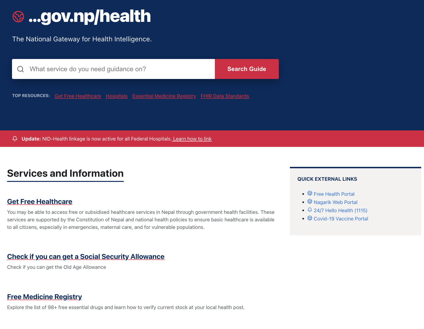
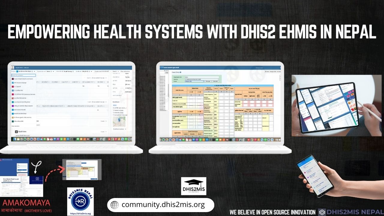
Comprehensive Digital Health Infrastructure
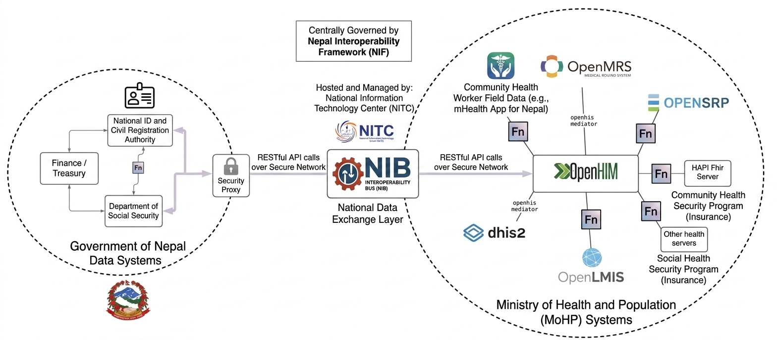
Nepal’s CIHIS integrates national digital health systems DHIS2 HMIS, eLMIS, CRVS, EMR/EHR platforms, disease surveillance systems into a unified interoperable ecosystem. It enables seamless health information exchange across federal, provincial, and local levels.
National Registries & Standards
Establishes national-level registries including client, health facility, health worker, and health product registries under MoHP coordination. Uses global standards like HL7 FHIR, ICD-11, and SNOMED CT to ensure data consistency, interoperability, and a single source of truth.
Data Analytics & Decision Support
Enables real-time dashboards, GIS-based health mapping, and predictive analytics for maternal health, disease surveillance, vaccine coverage, and supply chain monitoring. Supports evidence-based planning and policy making at all levels of government in Nepal.
Health Information Exchange (HIE)
Implements a national interoperability layer using FHIR-based APIs, master patient indexing, and standardized data exchange protocols to connect fragmented health systems and enable secure data sharing across providers and institutions.
Governance & SDG Alignment
Governed by the Ministry of Health and Population (MoHP), CIHIS aligns with Nepal’s eHealth Strategy and supports SDG 3 (Good Health), SDG 9 (Infrastructure), SDG 10 (Equity), SDG 16 (Institutions), and SDG 17 (Partnerships) through a unified national digital health ecosystem.
SDG Alignment
Aamako Maya digital health ecosystem by enabling interoperable, data-driven, and equitable healthcare aligned with SDGs 3, 9, 10, 16, and 17.
Learn about Aamako Maya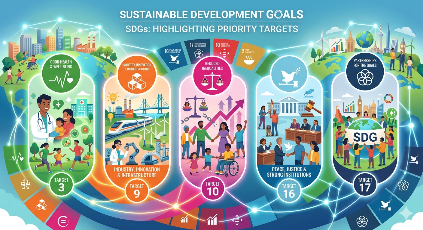
75+
Municipalities Supported
96%
Data Accuracy Increase
24/7
Technical Field Support
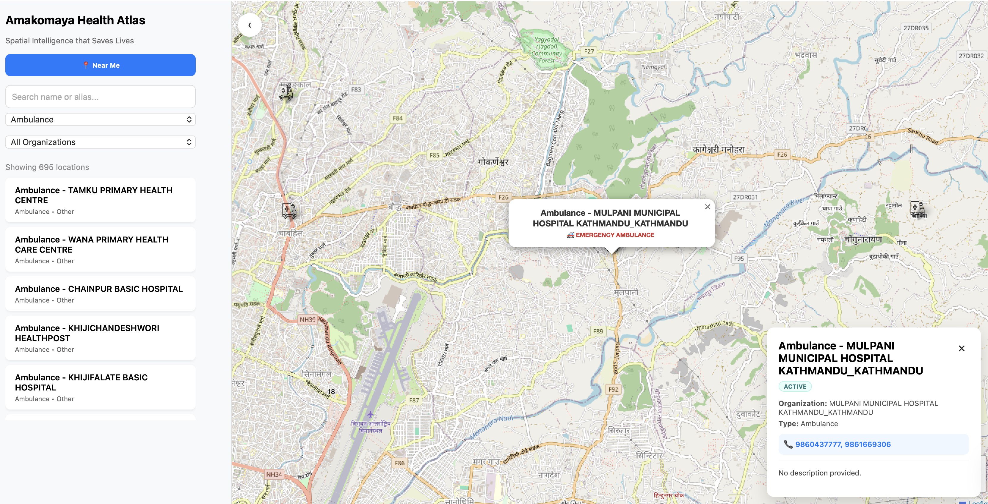
Aamako Maya Digital Health Atlas
A geospatial intelligence monitoring health system performance and digital reach across Nepal.
How We Support Your Mission
Turning purpose into action, systems, and measurable impact.
Strategic Alignment
We help refine your mission to ensure it guides daily decision-making, hiring, and supplier selection, rather than just being a plaque on the wall.
Actionable Frameworks
We translate abstract goals into concrete actions, allowing you to live out your mission daily and adapt it as your organization evolves.
Goal Implementation
We help develop products, services, and company policies that reflect your core purpose, ensuring every part of your organization contributes to the goal.
Focus and Clarity
We provide tools to define what your organization stands for, preventing drift caused by chasing funding or donor trends.
Cultural Integration
We help you engage employees and stakeholders by communicating the "why" behind the mission, building a shared culture of purpose.
Personalized Mission Support
For individuals, we help define personal values and strengths to create a personal mission statement that leads to purposeful work.


Trusted by our partners
We work with global development agencies and national institutions to build resilient digital health ecosystems in Nepal.

Government
Aligning digital interventions with the Ministry of Health (MoHP) and local municipality standards for long-term sustainability.
Governance Model >INGOs & NGOs
Providing the technical implementation layer for international development projects focusing on maternal and child health.
Partner Services >Research & Academia
Collaborating on PhD-led studies for health informatics frameworks and secure data exchange protocols.
Academic Papers >